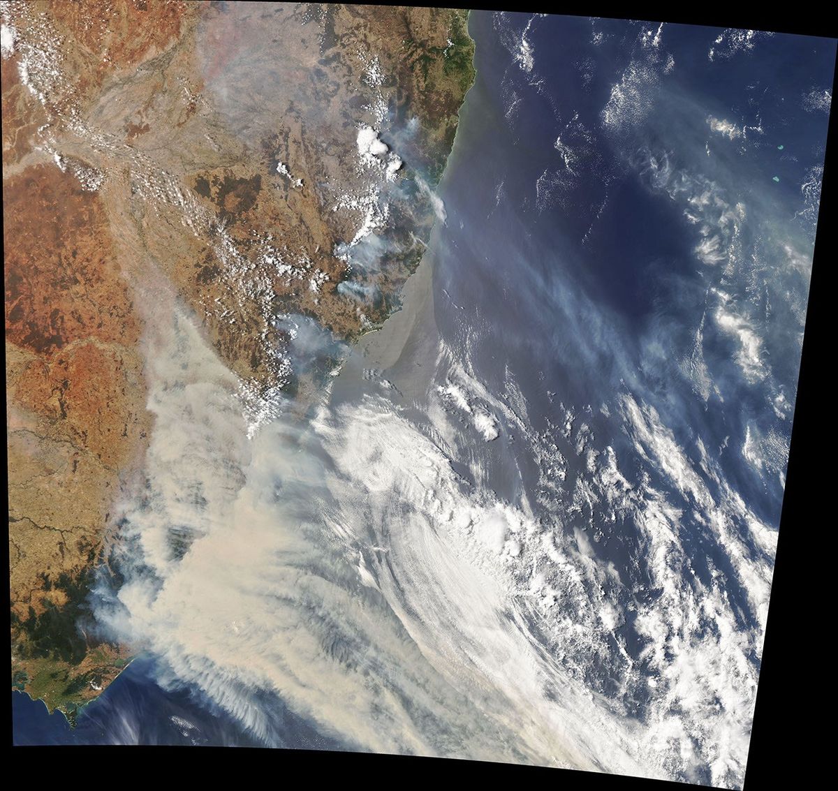
Smoke from Australia’s bushfires blanketed large parts of the southeast at the start of the year. Satellite imagery released Friday by NASA’s Earth Observatory shows how far the smoke spread beyond the areas where the fires were burning.
A map of the fire perimeter tells residents where flames are active. A satellite view can answer a different question: where the wind carries smoke and how much of the landscape it covers. Communities well away from the fires can still have their days interrupted by what the wind brings them.
The differences between those maps matter for people deciding how to help. Some towns are coping with fire itself while others are receiving displaced neighbors or trying to keep ordinary services available under a blanket of smoke.
Reporting source. Cover photograph: NASA Earth Observatory image by Joshua Stevens using MODIS data. Image license.